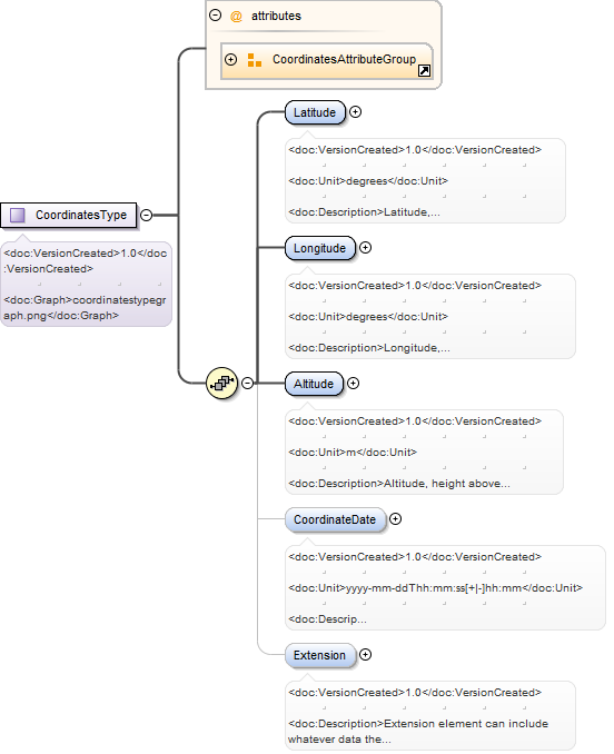
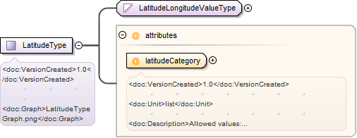
1.0listAllowed values: "North", "South". Registered according to coordinateReferenceSystem and receiverPosition.
Source
<xsd:element name="Latitude" type="LatitudeType"><xsd:annotation><xsd:documentation><doc:VersionCreated>1.0</doc:VersionCreated><doc:Unit>degrees</doc:Unit><doc:Description>Latitude, absolute value. Preferably 7 decimals to be registered. Registered according to coordinateReferenceSystem and receiverPosition.</doc:Description></xsd:documentation></xsd:annotation></xsd:element>
1.0listAllowed values: "East", "West". Registered according to coordinateReferenceSystem and receiverPosition.
Source
<xsd:element name="Longitude" type="LongitudeType"><xsd:annotation><xsd:documentation><doc:VersionCreated>1.0</doc:VersionCreated><doc:Unit>degrees</doc:Unit><doc:Description>Longitude, absolute value. Preferably 7 decimals to be registered. Registered according to coordinateReferenceSystem and receiverPosition.</doc:Description></xsd:documentation></xsd:annotation></xsd:element>
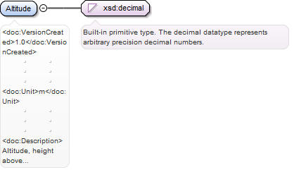
1.0mAltitude, height above sea level, registered according to CoordinateReference and CoordinateType.
Diagram
Type
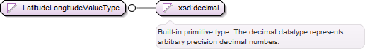
xsd:decimal
Properties
content:
simple
Source
<xsd:element name="Altitude" type="xsd:decimal"><xsd:annotation><xsd:documentation><doc:VersionCreated>1.0</doc:VersionCreated><doc:Unit>m</doc:Unit><doc:Description>Altitude, height above sea level, registered according to CoordinateReference and CoordinateType.</doc:Description></xsd:documentation></xsd:annotation></xsd:element>
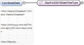
1.0yyyy-mm-ddThh:mm:ss[+|-]hh:mmDate and time when recording coordinate data. Time stamp must have the following times registered: local time ±offset from
UTC.
<xsd:element name="CoordinateDate" type="StanForD2010DateTimeType" minOccurs="0"><xsd:annotation><xsd:documentation><doc:VersionCreated>1.0</doc:VersionCreated><doc:Unit>yyyy-mm-ddThh:mm:ss[+|-]hh:mm</doc:Unit><doc:Description>Date and time when recording coordinate data. Time stamp must have the following times registered: local time ±offset from UTC.</doc:Description></xsd:documentation></xsd:annotation></xsd:element>
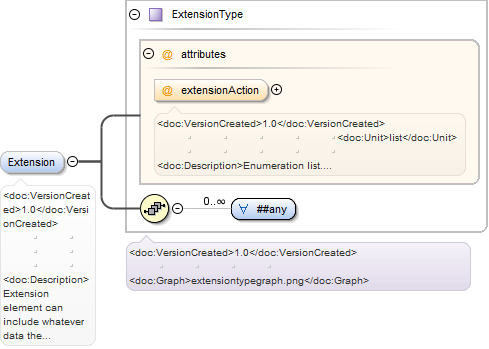
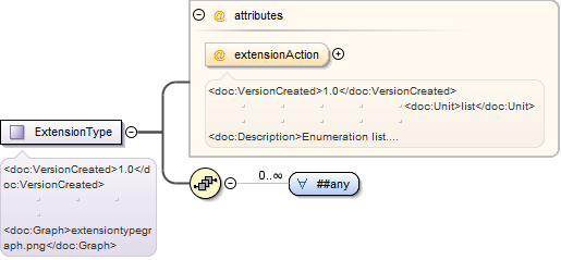
1.0listEnumeration list. Allowed values are: "Copy" and "Ignore". The purpose of this attribute is to inform the receiver of the
message that sender want to get back the copy of the content of the extension structure. For example if we have product specifiic
information in extension structure send in pin-message we might want that back in hpr-message.
Source
<xsd:element name="Extension" type="ExtensionType" minOccurs="0"><xsd:annotation><xsd:documentation><doc:VersionCreated>1.0</doc:VersionCreated><doc:Description>Extension element can include whatever data the users want. The only requirement is that it is well-formed XML i.e. it is tagged</doc:Description></xsd:documentation></xsd:annotation></xsd:element>
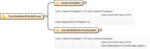
1.0listPosition of coordinate registration in file: "Base machine position", "Crane tip position when felling the tree. Observe that
only "Base machine position“ is relevant for all types of coordinates. Other enumerations valid only in some specific situations."
Source
<xsd:complexType name="CoordinatesType"><xsd:annotation><xsd:documentation><doc:VersionCreated>1.0</doc:VersionCreated><doc:Graph>coordinatestypegraph.png</doc:Graph></xsd:documentation></xsd:annotation><xsd:sequence><xsd:element name="Latitude" type="LatitudeType"><xsd:annotation><xsd:documentation><doc:VersionCreated>1.0</doc:VersionCreated><doc:Unit>degrees</doc:Unit><doc:Description>Latitude, absolute value. Preferably 7 decimals to be registered. Registered according to coordinateReferenceSystem and receiverPosition.</doc:Description></xsd:documentation></xsd:annotation></xsd:element><xsd:element name="Longitude" type="LongitudeType"><xsd:annotation><xsd:documentation><doc:VersionCreated>1.0</doc:VersionCreated><doc:Unit>degrees</doc:Unit><doc:Description>Longitude, absolute value. Preferably 7 decimals to be registered. Registered according to coordinateReferenceSystem and receiverPosition.</doc:Description></xsd:documentation></xsd:annotation></xsd:element><xsd:element name="Altitude" type="xsd:decimal"><xsd:annotation><xsd:documentation><doc:VersionCreated>1.0</doc:VersionCreated><doc:Unit>m</doc:Unit><doc:Description>Altitude, height above sea level, registered according to CoordinateReference and CoordinateType.</doc:Description></xsd:documentation></xsd:annotation></xsd:element><xsd:element name="CoordinateDate" type="StanForD2010DateTimeType" minOccurs="0"><xsd:annotation><xsd:documentation><doc:VersionCreated>1.0</doc:VersionCreated><doc:Unit>yyyy-mm-ddThh:mm:ss[+|-]hh:mm</doc:Unit><doc:Description>Date and time when recording coordinate data. Time stamp must have the following times registered: local time ±offset from UTC.</doc:Description></xsd:documentation></xsd:annotation></xsd:element><xsd:element name="Extension" type="ExtensionType" minOccurs="0"><xsd:annotation><xsd:documentation><doc:VersionCreated>1.0</doc:VersionCreated><doc:Description>Extension element can include whatever data the users want. The only requirement is that it is well-formed XML i.e. it is tagged</doc:Description></xsd:documentation></xsd:annotation></xsd:element></xsd:sequence><xsd:attributeGroup ref="CoordinatesAttributeGroup"/></xsd:complexType>
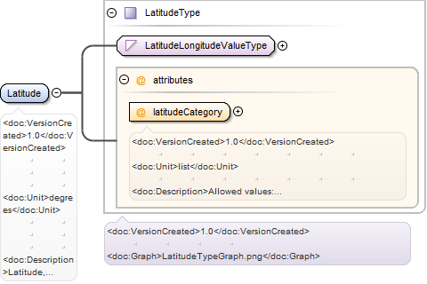
1.0listAllowed values: "North", "South". Registered according to coordinateReferenceSystem and receiverPosition.
Source
<xsd:complexType name="LatitudeType"><xsd:annotation><xsd:documentation><doc:VersionCreated>1.0</doc:VersionCreated><doc:Graph>LatitudeTypeGraph.png</doc:Graph></xsd:documentation></xsd:annotation><xsd:simpleContent><xsd:extension base="LatitudeLongitudeValueType"><xsd:attribute name="latitudeCategory" type="LatitudeCategoryType" use="required"><xsd:annotation><xsd:documentation><doc:VersionCreated>1.0</doc:VersionCreated><doc:Unit>list</doc:Unit><doc:Description>Allowed values: "North", "South". Registered according to coordinateReferenceSystem and receiverPosition.</doc:Description></xsd:documentation></xsd:annotation></xsd:attribute></xsd:extension></xsd:simpleContent></xsd:complexType>
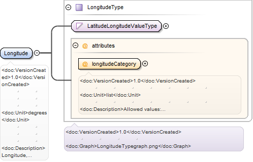
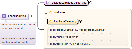
1.0listAllowed values: "East", "West". Registered according to coordinateReferenceSystem and receiverPosition.
Source
<xsd:complexType name="LongitudeType"><xsd:annotation><xsd:documentation><doc:VersionCreated>1.0</doc:VersionCreated><doc:Graph>LongitudeTypegraph.png</doc:Graph></xsd:documentation></xsd:annotation><xsd:simpleContent><xsd:extension base="LatitudeLongitudeValueType"><xsd:attribute name="longitudeCategory" type="LongitudeCategoryType" use="required"><xsd:annotation><xsd:documentation><doc:VersionCreated>1.0</doc:VersionCreated><doc:Unit>list</doc:Unit><doc:Description>Allowed values: "East", "West". Registered according to coordinateReferenceSystem and receiverPosition.</doc:Description></xsd:documentation></xsd:annotation></xsd:attribute></xsd:extension></xsd:simpleContent></xsd:complexType>
1.0listEnumeration list. Allowed values are: "Copy" and "Ignore". The purpose of this attribute is to inform the receiver of the
message that sender want to get back the copy of the content of the extension structure. For example if we have product specifiic
information in extension structure send in pin-message we might want that back in hpr-message.
Source
<xsd:complexType name="ExtensionType"><xsd:annotation><xsd:documentation><doc:VersionCreated>1.0</doc:VersionCreated><doc:Graph>extensiontypegraph.png</doc:Graph></xsd:documentation></xsd:annotation><xsd:sequence><xsd:any namespace="##any" processContents="lax" minOccurs="0" maxOccurs="unbounded"/></xsd:sequence><xsd:attribute name="extensionAction" type="ExtensionActionType"><xsd:annotation><xsd:documentation><doc:VersionCreated>1.0</doc:VersionCreated><doc:Unit>list</doc:Unit><doc:Description>Enumeration list. Allowed values are: "Copy" and "Ignore". The purpose of this attribute is to inform the receiver of the message that sender want to get back the copy of the content of the extension structure. For example if we have product specifiic information in extension structure send in pin-message we might want that back in hpr-message.</doc:Description></xsd:documentation></xsd:annotation></xsd:attribute></xsd:complexType>
<xsd:simpleType name="ReceiverPositionType"><xsd:restriction base="xsd:string"><xsd:enumeration value="Base machine position"/><xsd:enumeration value="Crane tip position when felling the tree"/></xsd:restriction></xsd:simpleType>
<xsd:attribute name="latitudeCategory" type="LatitudeCategoryType" use="required"><xsd:annotation><xsd:documentation><doc:VersionCreated>1.0</doc:VersionCreated><doc:Unit>list</doc:Unit><doc:Description>Allowed values: "North", "South". Registered according to coordinateReferenceSystem and receiverPosition.</doc:Description></xsd:documentation></xsd:annotation></xsd:attribute>
<xsd:attribute name="longitudeCategory" type="LongitudeCategoryType" use="required"><xsd:annotation><xsd:documentation><doc:VersionCreated>1.0</doc:VersionCreated><doc:Unit>list</doc:Unit><doc:Description>Allowed values: "East", "West". Registered according to coordinateReferenceSystem and receiverPosition.</doc:Description></xsd:documentation></xsd:annotation></xsd:attribute>
1.0listEnumeration list. Allowed values are: "Copy" and "Ignore". The purpose of this attribute is to inform the receiver of the
message that sender want to get back the copy of the content of the extension structure. For example if we have product specifiic
information in extension structure send in pin-message we might want that back in hpr-message.
<xsd:attribute name="extensionAction" type="ExtensionActionType"><xsd:annotation><xsd:documentation><doc:VersionCreated>1.0</doc:VersionCreated><doc:Unit>list</doc:Unit><doc:Description>Enumeration list. Allowed values are: "Copy" and "Ignore". The purpose of this attribute is to inform the receiver of the message that sender want to get back the copy of the content of the extension structure. For example if we have product specifiic information in extension structure send in pin-message we might want that back in hpr-message.</doc:Description></xsd:documentation></xsd:annotation></xsd:attribute>
1.0listPosition of coordinate registration in file: "Base machine position", "Crane tip position when felling the tree. Observe that
only "Base machine position“ is relevant for all types of coordinates. Other enumerations valid only in some specific situations."
<xsd:attribute name="receiverPosition" type="ReceiverPositionType" use="required"><xsd:annotation><xsd:documentation><doc:VersionCreated>1.0</doc:VersionCreated><doc:Unit>list</doc:Unit><doc:Description>Position of coordinate registration in file: "Base machine position", "Crane tip position when felling the tree. Observe that only "Base machine position“ is relevant for all types of coordinates. Other enumerations valid only in some specific situations."</doc:Description></xsd:documentation></xsd:annotation></xsd:attribute>
<xsd:attribute name="coordinateReferenceSystem" type="CoordinateReferenceSystemType" use="required"><xsd:annotation><xsd:documentation><doc:VersionCreated>1.0</doc:VersionCreated><doc:Unit>list</doc:Unit><doc:Description>Coordinate system used in StanForD file: WGS84</doc:Description></xsd:documentation></xsd:annotation></xsd:attribute>
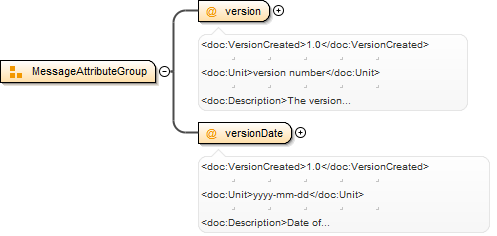
1.0version numberThe version number of the message in format: "major"."minor", where "major" is a sequential number of the major version (start
from 1) and "minor" is a sequential number of the minor version.>
<xsd:attribute name="version" type="StanForD2010VersionType" use="required"><xsd:annotation><xsd:documentation><doc:VersionCreated>1.0</doc:VersionCreated><doc:Unit>version number</doc:Unit><doc:Description>The version number of the message in format: "major"."minor", where "major" is a sequential number of the major version (start from 1) and "minor" is a sequential number of the minor version.></doc:Description></xsd:documentation></xsd:annotation></xsd:attribute>
1.0listPosition of coordinate registration in file: "Base machine position", "Crane tip position when felling the tree. Observe that
only "Base machine position“ is relevant for all types of coordinates. Other enumerations valid only in some specific situations."
Source
<xsd:attributeGroup name="CoordinatesAttributeGroup"><xsd:attribute name="receiverPosition" type="ReceiverPositionType" use="required"><xsd:annotation><xsd:documentation><doc:VersionCreated>1.0</doc:VersionCreated><doc:Unit>list</doc:Unit><doc:Description>Position of coordinate registration in file: "Base machine position", "Crane tip position when felling the tree. Observe that only "Base machine position“ is relevant for all types of coordinates. Other enumerations valid only in some specific situations."</doc:Description></xsd:documentation></xsd:annotation></xsd:attribute><xsd:attribute name="coordinateReferenceSystem" type="CoordinateReferenceSystemType" use="required"><xsd:annotation><xsd:documentation><doc:VersionCreated>1.0</doc:VersionCreated><doc:Unit>list</doc:Unit><doc:Description>Coordinate system used in StanForD file: WGS84</doc:Description></xsd:documentation></xsd:annotation></xsd:attribute></xsd:attributeGroup>
1.0version numberThe version number of the message in format: "major"."minor", where "major" is a sequential number of the major version (start
from 1) and "minor" is a sequential number of the minor version.>
<xsd:attributeGroup name="MessageAttributeGroup"><xsd:attribute name="version" type="StanForD2010VersionType" use="required"><xsd:annotation><xsd:documentation><doc:VersionCreated>1.0</doc:VersionCreated><doc:Unit>version number</doc:Unit><doc:Description>The version number of the message in format: "major"."minor", where "major" is a sequential number of the major version (start from 1) and "minor" is a sequential number of the minor version.></doc:Description></xsd:documentation></xsd:annotation></xsd:attribute><xsd:attribute name="versionDate" type="xsd:date" use="required"><xsd:annotation><xsd:documentation><doc:VersionCreated>1.0</doc:VersionCreated><doc:Unit>yyyy-mm-dd</doc:Unit><doc:Description>Date of version</doc:Description></xsd:documentation></xsd:annotation></xsd:attribute></xsd:attributeGroup>