How to encode reference system definitions. Builds on several other parts of GML 3 to encode the data needed to define reference
systems.
This schema encodes the Reference System (RS_) package of the extended UML Model for OGC Abstract Specification Topic 2:
Spatial Referencing by Coordinates. That UML model is adapted from ISO 19111 - Spatial referencing by coordinates, as described
in Annex C of Topic 2. The SC_CRS class is also encoded here, to eliminate the (circular) references from coordinateOperations.xsd
to coordinateReferenceSystems.xsd. The RS_SpatialReferenceSystemUsingGeographicIdentifier class is not encoded, since it is
not applicable to coordinate positions. The CI_Citation class is not directly encoded, since such information can be included
as metaDataProperty elements which are optionally allowed. A modified version of the EX_Extent (DataType) class from ISO 19115
is currently encoded here, using GML 3 schema types. (A more extensive version of the EX_Extent package might be XML encoded
in the future, probably in a separate extent.xsd schema.)
Caution: The CRS package in GML 3.1 and GML 3.1.1 is preliminary, and is expected to undergo some modifications that are
not backward compatible during the development of GML 3.2 (ISO 19136). The GML 3.2 package will implement the model described
in the revised version of ISO 19111.
GML is an OGC Standard.
Copyright (c) 2001,2005,2010 Open Geospatial Consortium.
To obtain additional rights of use, visit http://www.opengeospatial.org/legal/ .
Properties
attribute form default:
unqualified
element form default:
qualified
version:
3.1.1.2
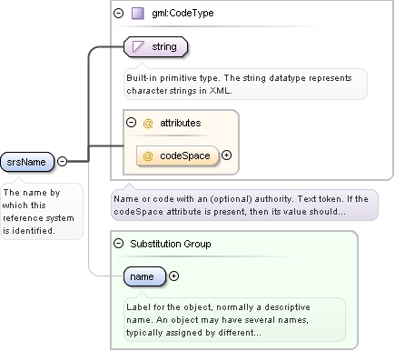
Element gml:srsName
Namespace
http://www.opengis.net/gml
Annotations
The name by which this reference system is identified.
<element name="srsName" type="gml:CodeType" substitutionGroup="gml:name"><annotation><documentation>The name by which this reference system is identified.</documentation></annotation></element>
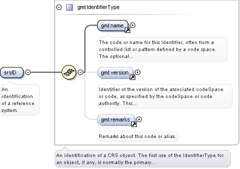
<element name="srsID" type="gml:IdentifierType"><annotation><documentation>An identification of a reference system.</documentation></annotation></element>
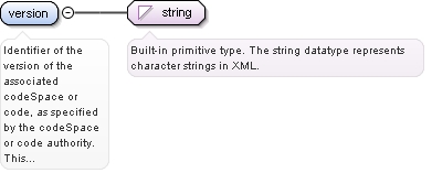
Element gml:version
Namespace
http://www.opengis.net/gml
Annotations
Identifier of the version of the associated codeSpace or code, as specified by the codeSpace or code authority. This version
is included only when the "code" or "codeSpace" uses versions. When appropriate, the version is identified by the effective
date, coded using ISO 8601 date format.
<element name="version" type="string"><annotation><documentation>Identifier of the version of the associated codeSpace or code, as specified by the codeSpace or code authority. This version is included only when the "code" or "codeSpace" uses versions. When appropriate, the version is identified by the effective date, coded using ISO 8601 date format.</documentation></annotation></element>
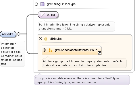
Element gml:remarks
Namespace
http://www.opengis.net/gml
Annotations
Information about this object or code. Contains text or refers to external text.
Reference to an XML Schema fragment that specifies the content model of the propertys value. This is in conformance with the
XML Schema Section 4.14 Referencing Schemas from Elsewhere.
<element name="remarks" type="gml:StringOrRefType"><annotation><documentation>Information about this object or code. Contains text or refers to external text.</documentation></annotation></element>
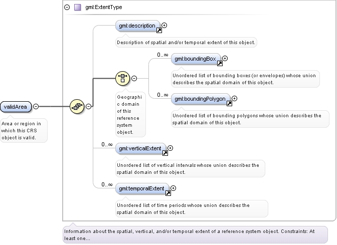
<element name="validArea" type="gml:ExtentType"><annotation><documentation>Area or region in which this CRS object is valid.</documentation></annotation></element>
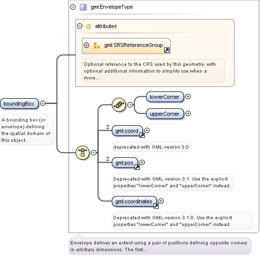
Element gml:boundingBox
Namespace
http://www.opengis.net/gml
Annotations
A bounding box (or envelope) defining the spatial domain of this object.
Ordered list of labels for all the axes of this CRS. The gml:axisAbbrev value should be used for these axis
labels, after spaces and forbiddden characters are removed. When the srsName attribute is included, this attribute is
optional.
When the srsName attribute is omitted, this attribute shall also be omitted.
The "srsDimension" is the length of coordinate sequence (the number of entries in the list). This dimension is
specified by the coordinate reference system. When the srsName attribute is omitted, this attribute shall be omitted.
In general this reference points to a CRS instance of gml:CoordinateReferenceSystemType
(see coordinateReferenceSystems.xsd). For well known references it is not required that the CRS description exists at
the
location the URI points to. If no srsName attribute is given, the CRS must be specified as part of the larger context
this
geometry element is part of, e.g. a geometric element like point, curve, etc. It is expected that this attribute will
be specified
at the direct position level only in rare cases.
Ordered list of unit of measure (uom) labels for all the axes of this CRS. The value of the string in the
gml:catalogSymbol should be used for this uom labels, after spaces and forbiddden characters are removed. When the
axisLabels attribute is included, this attribute shall also be included. When the axisLabels attribute is omitted, this
attribute
shall also be omitted.
Source
<element name="boundingBox" type="gml:EnvelopeType"><annotation><documentation>A bounding box (or envelope) defining the spatial domain of this object.</documentation></annotation></element>
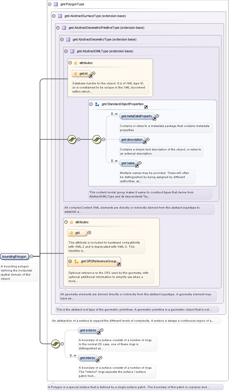
Element gml:boundingPolygon
Namespace
http://www.opengis.net/gml
Annotations
A bounding polygon defining the horizontal spatial domain of this object.
Ordered list of labels for all the axes of this CRS. The gml:axisAbbrev value should be used for these axis
labels, after spaces and forbiddden characters are removed. When the srsName attribute is included, this attribute is
optional.
When the srsName attribute is omitted, this attribute shall also be omitted.
This attribute is included for backward compatibility with GML 2 and is deprecated with GML 3.
This identifer is superceded by "gml:id" inherited from AbstractGMLType. The attribute "gid" should not be used
anymore and may be deleted in future versions of GML without further notice.
Database handle for the object. It is of XML type ID, so is constrained to be unique in the XML document within which it
occurs. An external identifier for the object in the form of a URI may be constructed using standard XML and XPointer methods.
This is done by concatenating the URI for the document, a fragment separator, and the value of the id attribute.
The "srsDimension" is the length of coordinate sequence (the number of entries in the list). This dimension is
specified by the coordinate reference system. When the srsName attribute is omitted, this attribute shall be omitted.
In general this reference points to a CRS instance of gml:CoordinateReferenceSystemType
(see coordinateReferenceSystems.xsd). For well known references it is not required that the CRS description exists at
the
location the URI points to. If no srsName attribute is given, the CRS must be specified as part of the larger context
this
geometry element is part of, e.g. a geometric element like point, curve, etc. It is expected that this attribute will
be specified
at the direct position level only in rare cases.
Ordered list of unit of measure (uom) labels for all the axes of this CRS. The value of the string in the
gml:catalogSymbol should be used for this uom labels, after spaces and forbiddden characters are removed. When the
axisLabels attribute is included, this attribute shall also be included. When the axisLabels attribute is omitted, this
attribute
shall also be omitted.
Source
<element name="boundingPolygon" type="gml:PolygonType"><annotation><documentation>A bounding polygon defining the horizontal spatial domain of this object.</documentation></annotation></element>
Element gml:verticalExtent
Namespace
http://www.opengis.net/gml
Annotations
An interval defining the vertical spatial domain of this object.
Ordered list of labels for all the axes of this CRS. The gml:axisAbbrev value should be used for these axis
labels, after spaces and forbiddden characters are removed. When the srsName attribute is included, this attribute is
optional.
When the srsName attribute is omitted, this attribute shall also be omitted.
The "srsDimension" is the length of coordinate sequence (the number of entries in the list). This dimension is
specified by the coordinate reference system. When the srsName attribute is omitted, this attribute shall be omitted.
In general this reference points to a CRS instance of gml:CoordinateReferenceSystemType
(see coordinateReferenceSystems.xsd). For well known references it is not required that the CRS description exists at
the
location the URI points to. If no srsName attribute is given, the CRS must be specified as part of the larger context
this
geometry element is part of, e.g. a geometric element like point, curve, etc. It is expected that this attribute will
be specified
at the direct position level only in rare cases.
Ordered list of unit of measure (uom) labels for all the axes of this CRS. The value of the string in the
gml:catalogSymbol should be used for this uom labels, after spaces and forbiddden characters are removed. When the
axisLabels attribute is included, this attribute shall also be included. When the axisLabels attribute is omitted, this
attribute
shall also be omitted.
Source
<element name="verticalExtent" type="gml:EnvelopeType"><annotation><documentation>An interval defining the vertical spatial domain of this object.</documentation></annotation></element>
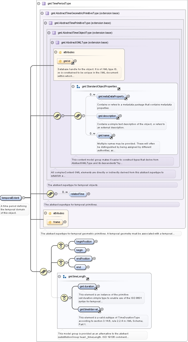
Element gml:temporalExtent
Namespace
http://www.opengis.net/gml
Annotations
A time period defining the temporal domain of this object.
Database handle for the object. It is of XML type ID, so is constrained to be unique in the XML document within which it
occurs. An external identifier for the object in the form of a URI may be constructed using standard XML and XPointer methods.
This is done by concatenating the URI for the document, a fragment separator, and the value of the id attribute.
Source
<element name="temporalExtent" type="gml:TimePeriodType"><annotation><documentation>A time period defining the temporal domain of this object.</documentation></annotation></element>
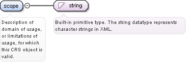
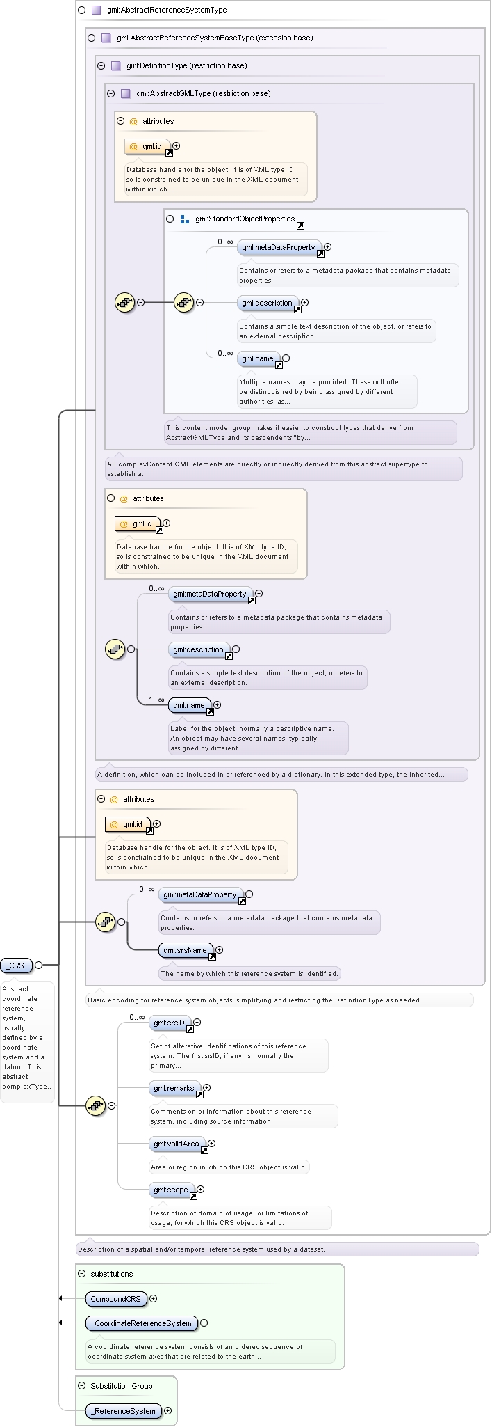
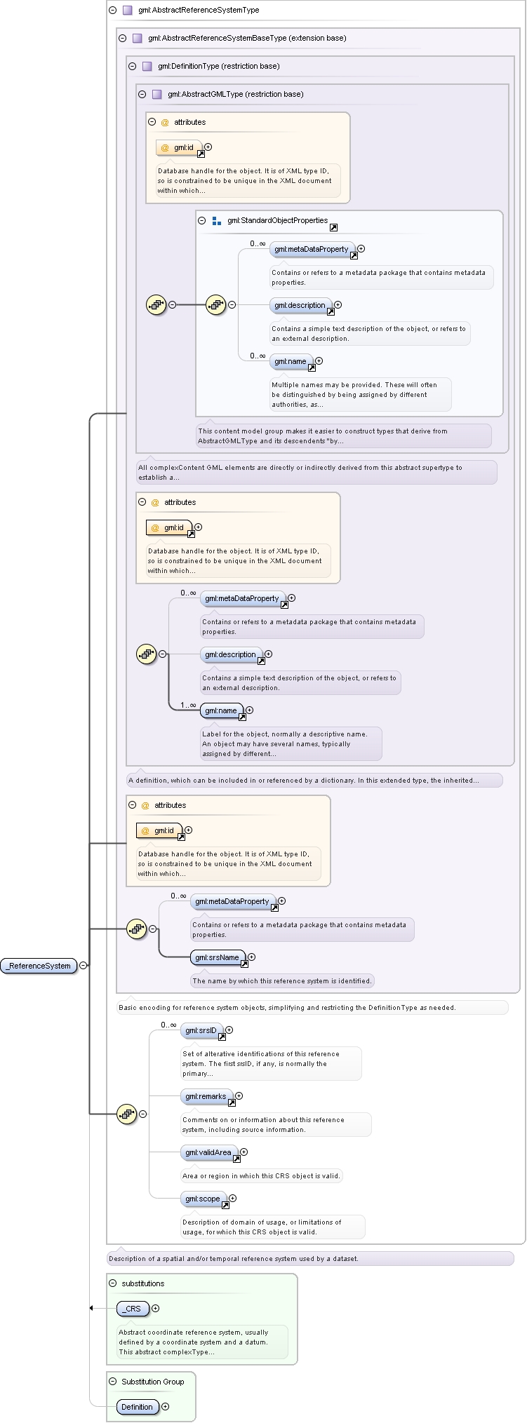
Element gml:scope
Namespace
http://www.opengis.net/gml
Annotations
Description of domain of usage, or limitations of usage, for which this CRS object is valid.
<element name="scope" type="string"><annotation><documentation>Description of domain of usage, or limitations of usage, for which this CRS object is valid.</documentation></annotation></element>
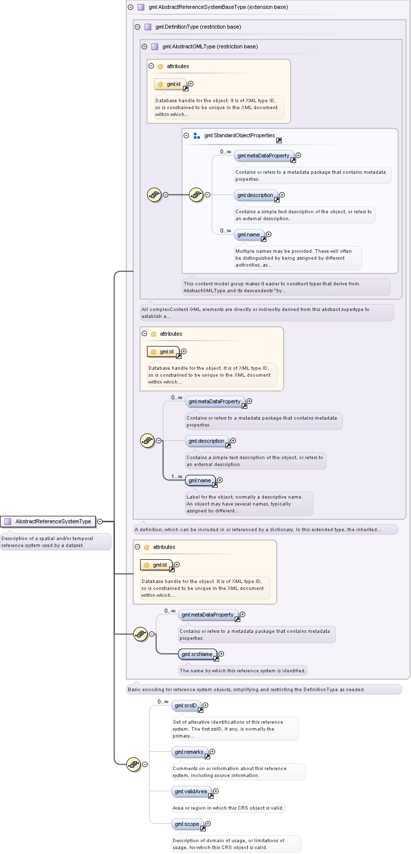
Element gml:_CRS
Namespace
http://www.opengis.net/gml
Annotations
Abstract coordinate reference system, usually defined by a coordinate system and a datum. This abstract complexType shall
not be used, extended, or restricted, in an Application Schema, to define a concrete subtype with a meaning equivalent to
a concrete subtype specified in this document.
Database handle for the object. It is of XML type ID, so is constrained to be unique in the XML document within which it
occurs. An external identifier for the object in the form of a URI may be constructed using standard XML and XPointer methods.
This is done by concatenating the URI for the document, a fragment separator, and the value of the id attribute.
Source
<element name="_CRS" type="gml:AbstractReferenceSystemType" abstract="true" substitutionGroup="gml:_ReferenceSystem"><annotation><documentation>Abstract coordinate reference system, usually defined by a coordinate system and a datum. This abstract complexType shall not be used, extended, or restricted, in an Application Schema, to define a concrete subtype with a meaning equivalent to a concrete subtype specified in this document.</documentation></annotation></element>
Database handle for the object. It is of XML type ID, so is constrained to be unique in the XML document within which it
occurs. An external identifier for the object in the form of a URI may be constructed using standard XML and XPointer methods.
This is done by concatenating the URI for the document, a fragment separator, and the value of the id attribute.
Reference to an XML Schema fragment that specifies the content model of the propertys value. This is in conformance with the
XML Schema Section 4.14 Referencing Schemas from Elsewhere.
Reference to an XML Schema fragment that specifies the content model of the propertys value. This is in conformance with the
XML Schema Section 4.14 Referencing Schemas from Elsewhere.
Database handle for the object. It is of XML type ID, so is constrained to be unique in the XML document within which it
occurs. An external identifier for the object in the form of a URI may be constructed using standard XML and XPointer methods.
This is done by concatenating the URI for the document, a fragment separator, and the value of the id attribute.
Source
<complexType name="AbstractReferenceSystemType" abstract="true"><annotation><documentation>Description of a spatial and/or temporal reference system used by a dataset.</documentation></annotation><complexContent><extension base="gml:AbstractReferenceSystemBaseType"><sequence><element ref="gml:srsID" minOccurs="0" maxOccurs="unbounded"><annotation><documentation>Set of alterative identifications of this reference system. The first srsID, if any, is normally the primary identification code, and any others are aliases.</documentation></annotation></element><element ref="gml:remarks" minOccurs="0"><annotation><documentation>Comments on or information about this reference system, including source information.</documentation></annotation></element><element ref="gml:validArea" minOccurs="0"/><element ref="gml:scope" minOccurs="0"/></sequence></extension></complexContent></complexType>
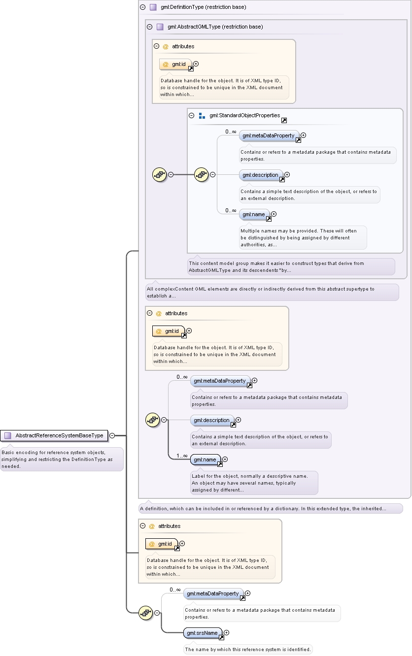
Complex Type gml:AbstractReferenceSystemBaseType
Namespace
http://www.opengis.net/gml
Annotations
Basic encoding for reference system objects, simplifying and restricting the DefinitionType as needed.
Database handle for the object. It is of XML type ID, so is constrained to be unique in the XML document within which it
occurs. An external identifier for the object in the form of a URI may be constructed using standard XML and XPointer methods.
This is done by concatenating the URI for the document, a fragment separator, and the value of the id attribute.
Source
<complexType name="AbstractReferenceSystemBaseType" abstract="true"><annotation><documentation>Basic encoding for reference system objects, simplifying and restricting the DefinitionType as needed.</documentation></annotation><complexContent><restriction base="gml:DefinitionType"><sequence><element ref="gml:metaDataProperty" minOccurs="0" maxOccurs="unbounded"/><element ref="gml:srsName"/></sequence><attribute ref="gml:id" use="required"/></restriction></complexContent></complexType>
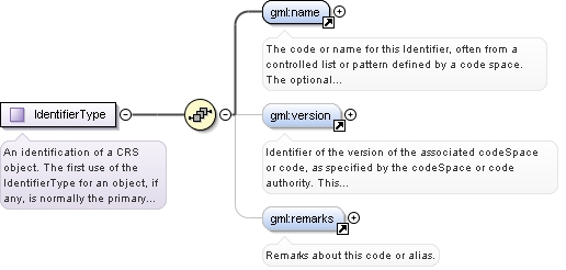
Complex Type gml:IdentifierType
Namespace
http://www.opengis.net/gml
Annotations
An identification of a CRS object. The first use of the IdentifierType for an object, if any, is normally the primary identification
code, and any others are aliases.
<complexType name="IdentifierType"><annotation><documentation>An identification of a CRS object. The first use of the IdentifierType for an object, if any, is normally the primary identification code, and any others are aliases.</documentation></annotation><sequence><element ref="gml:name"><annotation><documentation>The code or name for this Identifier, often from a controlled list or pattern defined by a code space. The optional codeSpace attribute is normally included to identify or reference a code space within which one or more codes are defined. This code space is often defined by some authority organization, where one organization may define multiple code spaces. The range and format of each Code Space identifier is defined by that code space authority. Information about that code space authority can be included as metaDataProperty elements which are optionally allowed in all CRS objects.</documentation></annotation></element><element ref="gml:version" minOccurs="0"/><element ref="gml:remarks" minOccurs="0"><annotation><documentation>Remarks about this code or alias.</documentation></annotation></element></sequence></complexType>
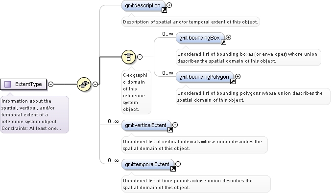
Complex Type gml:ExtentType
Namespace
http://www.opengis.net/gml
Annotations
Information about the spatial, vertical, and/or temporal extent of a reference system object. Constraints: At least one of
the elements "description", "boundingBox", "boundingPolygon", "verticalExtent", and temporalExtent" must be included, but
more that one can be included when appropriate. Furthermore, more than one "boundingBox", "boundingPolygon", "verticalExtent",
and/or temporalExtent" element can be included, with more than one meaning the union of the individual domains.
<complexType name="ExtentType"><annotation><documentation>Information about the spatial, vertical, and/or temporal extent of a reference system object. Constraints: At least one of the elements "description", "boundingBox", "boundingPolygon", "verticalExtent", and temporalExtent" must be included, but more that one can be included when appropriate. Furthermore, more than one "boundingBox", "boundingPolygon", "verticalExtent", and/or temporalExtent" element can be included, with more than one meaning the union of the individual domains.</documentation></annotation><sequence><element ref="gml:description" minOccurs="0"><annotation><documentation>Description of spatial and/or temporal extent of this object.</documentation></annotation></element><choice><annotation><documentation>Geographic domain of this reference system object.</documentation></annotation><element ref="gml:boundingBox" minOccurs="0" maxOccurs="unbounded"><annotation><documentation>Unordered list of bounding boxes (or envelopes) whose union describes the spatial domain of this object.</documentation></annotation></element><element ref="gml:boundingPolygon" minOccurs="0" maxOccurs="unbounded"><annotation><documentation>Unordered list of bounding polygons whose union describes the spatial domain of this object.</documentation></annotation></element></choice><element ref="gml:verticalExtent" minOccurs="0" maxOccurs="unbounded"><annotation><documentation>Unordered list of vertical intervals whose union describes the spatial domain of this object.</documentation></annotation></element><element ref="gml:temporalExtent" minOccurs="0" maxOccurs="unbounded"><annotation><documentation>Unordered list of time periods whose union describes the spatial domain of this object.</documentation></annotation></element></sequence></complexType>
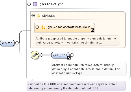
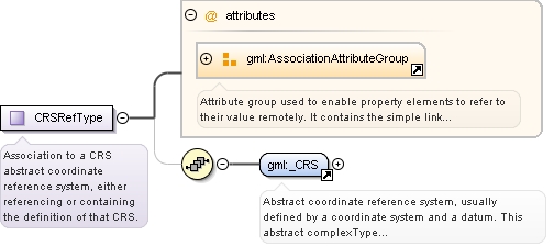
Complex Type gml:CRSRefType
Namespace
http://www.opengis.net/gml
Annotations
Association to a CRS abstract coordinate reference system, either referencing or containing the definition of that CRS.
Reference to an XML Schema fragment that specifies the content model of the propertys value. This is in conformance with the
XML Schema Section 4.14 Referencing Schemas from Elsewhere.
<complexType name="CRSRefType"><annotation><documentation>Association to a CRS abstract coordinate reference system, either referencing or containing the definition of that CRS.</documentation></annotation><sequence minOccurs="0"><element ref="gml:_CRS"/></sequence><attributeGroup ref="gml:AssociationAttributeGroup"/></complexType>
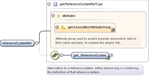
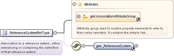
Complex Type gml:ReferenceSystemRefType
Namespace
http://www.opengis.net/gml
Annotations
Association to a reference system, either referencing or containing the definition of that reference system.
Reference to an XML Schema fragment that specifies the content model of the propertys value. This is in conformance with the
XML Schema Section 4.14 Referencing Schemas from Elsewhere.
<complexType name="ReferenceSystemRefType"><annotation><documentation>Association to a reference system, either referencing or containing the definition of that reference system.</documentation></annotation><sequence minOccurs="0"><element ref="gml:_ReferenceSystem"/></sequence><attributeGroup ref="gml:AssociationAttributeGroup"/></complexType>